 vesseltracker.com
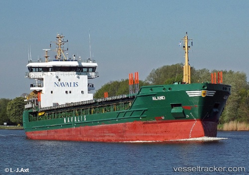
Vessel ALAND IMO: 9350783, MMSI: 255802540 General Cargo Ship
UTC, 58.37981, 24.47604, course: 194, speed: 0
UTC, 58.37833, 24.47500, course: -1, speed: 0
2026-02-09 06:48:04 UTC, 58.37833, 24.47500, course: -1, speed: 0
Live AIS position:
UTC. Near Pärnu Sadama Väikesadam),
updated 2026-02-09 06:48:04 UTC.
Find the position of the vessel ALAND on the map. The latter are known coordinates and path.
marine traffic ship tracker show on live map
The current position of vessel ALAND is 58.37833 lat / 24.47500 lng. Updated: 2026-02-09 06:48:04 UTCCurrently sailing under the flag of Portugal (MAR)
ALAND built in 2007 year
Deadweight:
7056 tDetails:
Last coordinates of the vessel:
UTC, 58.37980, 24.47606, course: 194, speed: 0UTC, 58.37981, 24.47604, course: 194, speed: 0
UTC, 58.37833, 24.47500, course: -1, speed: 0
2026-02-09 06:48:04 UTC, 58.37833, 24.47500, course: -1, speed: 0