 vesseltracker.com
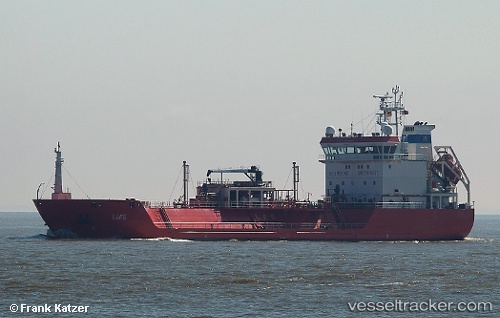
Vessel Luke IMO: 9356919, MMSI: 255802950 Lpg Tanker
UTC, 54.54265, 18.80225, course: 254, speed: 4.3
UTC, 54.52698, 18.55827, course: 85, speed: 0
2026-01-30 06:02:30 UTC, 54.52698, 18.55828, course: 85, speed: 0
Live AIS position:
UTC. Near Gdynia),
updated 2026-01-30 06:02:30 UTC.
Find the position of the vessel Luke on the map. The latter are known coordinates and path.
marine traffic ship tracker show on live map
The current position of vessel Luke is 54.52698 lat / 18.55828 lng. Updated: 2026-01-30 06:02:30 UTCCurrently sailing under the flag of Portugal
Luke built in 2006 year
Deadweight:
3811 tDetails:
Last coordinates of the vessel:
UTC, 54.81280, 18.87167, course: 124, speed: 11.2UTC, 54.54265, 18.80225, course: 254, speed: 4.3
UTC, 54.52698, 18.55827, course: 85, speed: 0
2026-01-30 06:02:30 UTC, 54.52698, 18.55828, course: 85, speed: 0