 vesseltracker.com
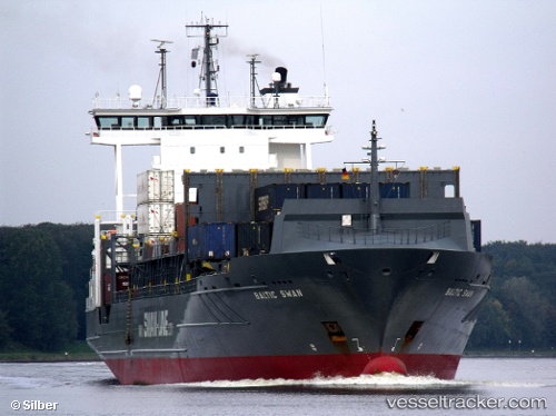
Vessel Akacia IMO: 9315020, MMSI: 255805555 Container Ship
UTC, 53.52967, 9.91433, course: 305, speed: 0
UTC, 53.53967, 9.91800, course: 90, speed: 0
2026-03-02 19:37:03 UTC, 53.53967, 9.91800, course: 91, speed: 0
Live AIS position:
UTC. Near Bahrenfeld),
updated 2026-03-02 19:37:03 UTC.
Find the position of the vessel Akacia on the map. The latter are known coordinates and path.
marine traffic ship tracker show on live map
The current position of vessel Akacia is 53.53967 lat / 9.91800 lng. Updated: 2026-03-02 19:37:03 UTCCurrently sailing under the flag of Portugal
Akacia built in 2004 year
Deadweight:
13713 tDetails:
Last coordinates of the vessel:
UTC, 53.52970, 9.91436, course: -1, speed: 0.1UTC, 53.52967, 9.91433, course: 305, speed: 0
UTC, 53.53967, 9.91800, course: 90, speed: 0
2026-03-02 19:37:03 UTC, 53.53967, 9.91800, course: 91, speed: 0