 vesseltracker.com
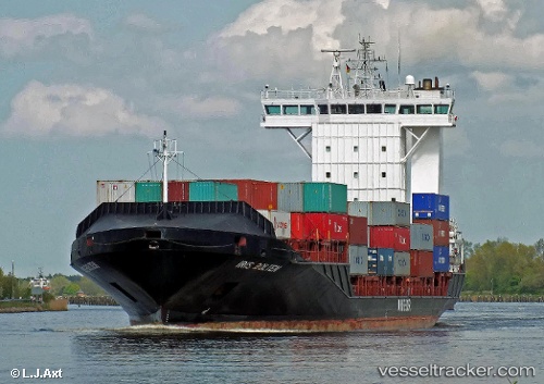
Vessel Elbstrom IMO: 9369007, MMSI: 255805577 Container Ship
UTC, 60.21590, 25.18633, course: 140, speed: 0
UTC, 60.21590, 25.18634, course: 139, speed: 0
2026-03-17 04:23:42 UTC, 60.21587, 25.18624, course: 140, speed: 0
Live Vessel Elbstrom Analytics (details, animations, etc.)
Live AIS position: UTC. Near Vuosaari (Nordsjö)), updated 2026-03-17 04:23:42 UTC.Find the position of the vessel Elbstrom on the map. The latter are known coordinates and path.
marine traffic ship tracker show on live map
The current position of vessel Elbstrom is 60.21587 lat / 25.18624 lng. Updated: 2026-03-17 04:23:42 UTCCurrently sailing under the flag of Portugal
Elbstrom built in 2008 year
Deadweight:
11051 tDetails:
Last coordinates of the vessel:
UTC, 60.21589, 25.18634, course: 140, speed: 0UTC, 60.21590, 25.18633, course: 140, speed: 0
UTC, 60.21590, 25.18634, course: 139, speed: 0
2026-03-17 04:23:42 UTC, 60.21587, 25.18624, course: 140, speed: 0