 vesseltracker.com
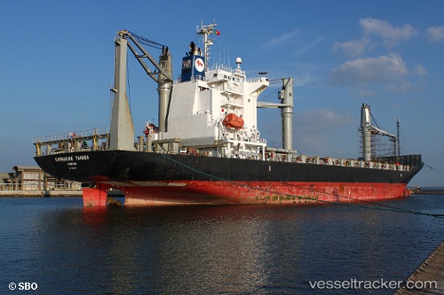
Vessel FERDINANDA S IMO: 9445019, MMSI: 255805603 Container Ship
UTC, 41.19285, -8.68654, course: 234, speed: 0
UTC, 41.19284, -8.68656, course: 232, speed: 0
2026-01-27 11:56:21 UTC, 41.19279, -8.68651, course: 232, speed: 0
Live AIS position:
UTC. Near Leça da Palmeira),
updated 2026-01-27 11:56:21 UTC.
Find the position of the vessel FERDINANDA S on the map. The latter are known coordinates and path.
marine traffic ship tracker show on live map
The current position of vessel FERDINANDA S is 41.19279 lat / -8.68651 lng. Updated: 2026-01-27 11:56:21 UTCCurrently sailing under the flag of Portugal (MAR)
FERDINANDA S built in 2008 year
Deadweight:
21464 tDetails:
Last coordinates of the vessel:
UTC, 41.19284, -8.68651, course: 233, speed: 0UTC, 41.19285, -8.68654, course: 234, speed: 0
UTC, 41.19284, -8.68656, course: 232, speed: 0
2026-01-27 11:56:21 UTC, 41.19279, -8.68651, course: 232, speed: 0