 vesseltracker.com
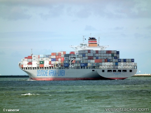
Vessel Maersk Launceston IMO: 9294408, MMSI: 255805664 Container Ship
UTC, -37.41197, 150.33795, course: 185, speed: 19.1
UTC, -37.85995, 150.05023, course: 232, speed: 18.8
2026-02-10 11:23:03 UTC, -38.10727, 149.55615, course: 236, speed: 18.3
Live AIS position:
UTC. 64 nm S of EDEN),
updated 2026-02-10 11:23:03 UTC.
Find the position of the vessel Maersk Launceston on the map. The latter are known coordinates and path.
marine traffic ship tracker show on live map
The current position of vessel Maersk Launceston is -38.10727 lat / 149.55615 lng. Updated: 2026-02-10 11:23:03 UTCDetails:
Last coordinates of the vessel:
UTC, -36.54077, 150.49898, course: 188, speed: 20UTC, -37.41197, 150.33795, course: 185, speed: 19.1
UTC, -37.85995, 150.05023, course: 232, speed: 18.8
2026-02-10 11:23:03 UTC, -38.10727, 149.55615, course: 236, speed: 18.3