 vesseltracker.com
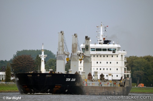
Vessel Don Juan IMO: 9394222, MMSI: 255805740 Bulk Carrier
UTC, 27.74833, -15.66833, course: -1, speed: 0
UTC, 27.74833, -15.66833, course: -1, speed: 0
2026-03-04 03:52:41 UTC, 27.74883, -15.66925, course: 286, speed: 0
Live AIS position:
UTC. Near ARGUINEGUIN),
updated 2026-03-04 03:52:41 UTC.
Find the position of the vessel Don Juan on the map. The latter are known coordinates and path.
marine traffic ship tracker show on live map
The current position of vessel Don Juan is 27.74883 lat / -15.66925 lng. Updated: 2026-03-04 03:52:41 UTCCurrently sailing under the flag of Portugal
Don Juan built in 2007 year
Deadweight:
21057 tDetails:
Last coordinates of the vessel:
UTC, 27.74833, -15.66833, course: -1, speed: 0UTC, 27.74833, -15.66833, course: -1, speed: 0
UTC, 27.74833, -15.66833, course: -1, speed: 0
2026-03-04 03:52:41 UTC, 27.74883, -15.66925, course: 286, speed: 0