 vesseltracker.com
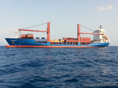
Vessel Laura S IMO: 9157868, MMSI: 255805890 Container Ship
UTC, 38.72341, -9.11064, course: -1, speed: 0
UTC, 38.72342, -9.11066, course: -1, speed: 0
2026-03-05 09:17:04 UTC, 38.72341, -9.11065, course: -1, speed: 0
Live Vessel Laura S Analytics (details, animations, etc.)
Live AIS position: UTC. Near Lisboa-EXPO), updated 2026-03-05 09:17:04 UTC.Find the position of the vessel Laura S on the map. The latter are known coordinates and path.
marine traffic ship tracker show on live map
The current position of vessel Laura S is 38.72341 lat / -9.11065 lng. Updated: 2026-03-05 09:17:04 UTCCurrently sailing under the flag of Portugal
Laura S built in 1998 year
Deadweight:
6770 tDetails:
Last coordinates of the vessel:
UTC, 38.72339, -9.11065, course: 220, speed: 0UTC, 38.72341, -9.11064, course: -1, speed: 0
UTC, 38.72342, -9.11066, course: -1, speed: 0
2026-03-05 09:17:04 UTC, 38.72341, -9.11065, course: -1, speed: 0