 vesseltracker.com
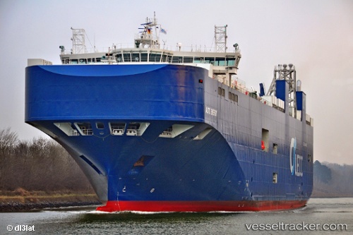
Vessel Auto Energy IMO: 9736377, MMSI: 255805908 Vehicles Carrier
UTC, 53.49036, 4.70687, course: 244, speed: 8.4
UTC, 53.23424, 4.48029, course: 203, speed: 8.3
2026-03-01 17:36:31 UTC, 53.11874, 4.27575, course: 229, speed: 8.3
Live AIS position:
UTC. 14 nm W of Molengat),
updated 2026-03-01 17:36:31 UTC.
Find the position of the vessel Auto Energy on the map. The latter are known coordinates and path.
marine traffic ship tracker show on live map
The current position of vessel Auto Energy is 53.11874 lat / 4.27575 lng. Updated: 2026-03-01 17:36:31 UTCCurrently sailing under the flag of Portugal
Details:
Last coordinates of the vessel:
UTC, 53.59197, 5.20922, course: 243, speed: 8UTC, 53.49036, 4.70687, course: 244, speed: 8.4
UTC, 53.23424, 4.48029, course: 203, speed: 8.3
2026-03-01 17:36:31 UTC, 53.11874, 4.27575, course: 229, speed: 8.3