 vesseltracker.com
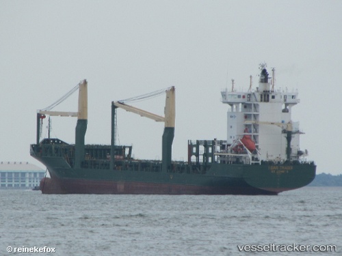
Vessel Msc Talia F IMO: 9308601, MMSI: 255805965 Container Ship
UTC, 39.70070, 17.23187, course: 171, speed: 10.7
UTC, 39.25388, 17.32306, course: 171, speed: 11
2026-03-06 17:22:10 UTC, 38.99332, 17.34735, course: 181, speed: 11.1
Live Vessel Msc Talia F Analytics (details, animations, etc.)
Live AIS position: UTC. 11 nm SE of CROTONE), updated 2026-03-06 17:22:10 UTC.Find the position of the vessel Msc Talia F on the map. The latter are known coordinates and path.
marine traffic ship tracker show on live map
The current position of vessel Msc Talia F is 38.99332 lat / 17.34735 lng. Updated: 2026-03-06 17:22:10 UTCCurrently sailing under the flag of Portugal
Msc Talia F built in 2005 year
Deadweight:
11815 tDetails:
Last coordinates of the vessel:
UTC, 39.96507, 17.18578, course: 171, speed: 10.5UTC, 39.70070, 17.23187, course: 171, speed: 10.7
UTC, 39.25388, 17.32306, course: 171, speed: 11
2026-03-06 17:22:10 UTC, 38.99332, 17.34735, course: 181, speed: 11.1