 vesseltracker.com
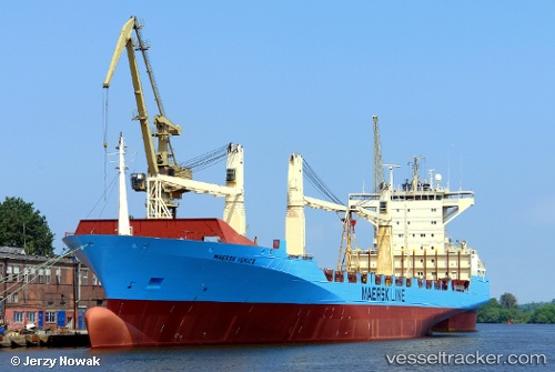
Vessel Msc Amy IMO: 9242651, MMSI: 255806081 Container Ship
UTC, 51.29667, 4.26167, course: -1, speed: 0
UTC, 51.29705, 4.26256, course: 211, speed: 0
2026-01-15 05:52:47 UTC, 51.29701, 4.26256, course: 211, speed: 0
Live AIS position:
UTC. Near Doel),
updated 2026-01-15 05:52:47 UTC.
Find the position of the vessel Msc Amy on the map. The latter are known coordinates and path.
marine traffic ship tracker show on live map
The current position of vessel Msc Amy is 51.29701 lat / 4.26256 lng. Updated: 2026-01-15 05:52:47 UTCCurrently sailing under the flag of Portugal
Msc Amy built in 2002 year
Deadweight:
22308 tDetails:
Last coordinates of the vessel:
UTC, 51.29693, 4.26279, course: 211, speed: 0UTC, 51.29667, 4.26167, course: -1, speed: 0
UTC, 51.29705, 4.26256, course: 211, speed: 0
2026-01-15 05:52:47 UTC, 51.29701, 4.26256, course: 211, speed: 0