 vesseltracker.com
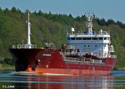
Vessel ORAMALIA IMO: 9392640, MMSI: 255806229 Chemical/Oil Products Tanker
UTC, 54.36562, 10.14270, course: 106, speed: 0
UTC, 54.55554, 10.63128, course: 83, speed: 10.8
2026-03-14 06:15:29 UTC, 54.54606, 11.27250, course: 109, speed: 10.7
Live Vessel ORAMALIA Analytics (details, animations, etc.)
Live AIS position: UTC. Near Bannesdorf), updated 2026-03-14 06:15:29 UTC.Find the position of the vessel ORAMALIA on the map. The latter are known coordinates and path.
marine traffic ship tracker show on live map
The current position of vessel ORAMALIA is 54.54606 lat / 11.27250 lng. Updated: 2026-03-14 06:15:29 UTCCurrently sailing under the flag of Portugal (MAR)
ORAMALIA built in 2007 year
Deadweight:
6863 tDetails:
Last coordinates of the vessel:
UTC, 54.35679, 9.87952, course: 127, speed: 1.7UTC, 54.36562, 10.14270, course: 106, speed: 0
UTC, 54.55554, 10.63128, course: 83, speed: 10.8
2026-03-14 06:15:29 UTC, 54.54606, 11.27250, course: 109, speed: 10.7