 vesseltracker.com
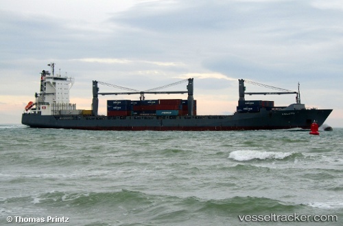
Vessel Violetta IMO: 9344710, MMSI: 255806258 Container Ship
UTC, 51.30167, 4.26667, course: -1, speed: 0
UTC, 51.30137, 4.26724, course: 32, speed: 0
2026-01-17 18:25:57 UTC, 51.30138, 4.26725, course: 31, speed: 0
Live AIS position:
UTC. Near Doel),
updated 2026-01-17 18:25:57 UTC.
Find the position of the vessel Violetta on the map. The latter are known coordinates and path.
marine traffic ship tracker show on live map
The current position of vessel Violetta is 51.30138 lat / 4.26725 lng. Updated: 2026-01-17 18:25:57 UTCCurrently sailing under the flag of Portugal
Violetta built in 2007 year
Deadweight:
22267 tDetails:
Last coordinates of the vessel:
UTC, 51.30137, 4.26724, course: 31, speed: 0UTC, 51.30167, 4.26667, course: -1, speed: 0
UTC, 51.30137, 4.26724, course: 32, speed: 0
2026-01-17 18:25:57 UTC, 51.30138, 4.26725, course: 31, speed: 0