 vesseltracker.com
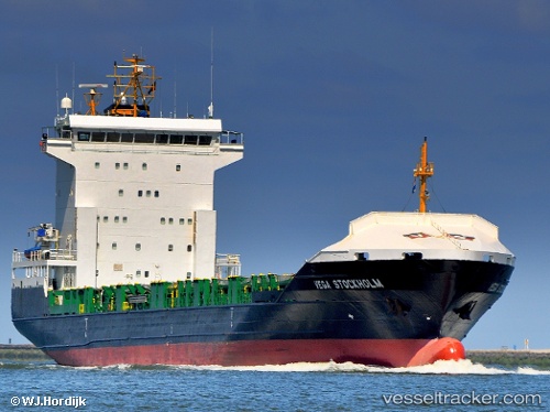
Vessel Sunaid X IMO: 9358539, MMSI: 255806259 Container Ship
UTC, 37.90443, 23.55976, course: 169, speed: 0.3
UTC, 37.90447, 23.55990, course: 178, speed: 0.3
2026-01-29 08:22:44 UTC, 37.90431, 23.55900, course: 161, speed: 0.1
Live AIS position:
UTC. Near PSYTTALEIA),
updated 2026-01-29 08:22:44 UTC.
Find the position of the vessel Sunaid X on the map. The latter are known coordinates and path.
marine traffic ship tracker show on live map
The current position of vessel Sunaid X is 37.90431 lat / 23.55900 lng. Updated: 2026-01-29 08:22:44 UTCCurrently sailing under the flag of Portugal
Sunaid X built in 2006 year
Deadweight:
8306 tDetails:
Last coordinates of the vessel:
UTC, 37.90468, 23.56035, course: 181, speed: 0UTC, 37.90443, 23.55976, course: 169, speed: 0.3
UTC, 37.90447, 23.55990, course: 178, speed: 0.3
2026-01-29 08:22:44 UTC, 37.90431, 23.55900, course: 161, speed: 0.1