 vesseltracker.com
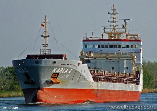
Vessel KARLA C IMO: 9558012, MMSI: 255806312 General Cargo Ship
UTC, 59.11673, 9.62373, course: 120, speed: 0
UTC, 59.11673, 9.62373, course: 120, speed: 0
2026-03-24 05:20:48 UTC, 59.11674, 9.62373, course: 120, speed: 0
Live Vessel KARLA C Analytics (details, animations, etc.)
Live AIS position: UTC. Near Herøya), updated 2026-03-24 05:20:48 UTC.Find the position of the vessel KARLA C on the map. The latter are known coordinates and path.
marine traffic ship tracker show on live map
The current position of vessel KARLA C is 59.11674 lat / 9.62373 lng. Updated: 2026-03-24 05:20:48 UTCCurrently sailing under the flag of Portugal (MAR)
KARLA C built in 2010 year
Deadweight:
6795 tDetails:
Last coordinates of the vessel:
UTC, 59.11673, 9.62375, course: -1, speed: 0UTC, 59.11673, 9.62373, course: 120, speed: 0
UTC, 59.11673, 9.62373, course: 120, speed: 0
2026-03-24 05:20:48 UTC, 59.11674, 9.62373, course: 120, speed: 0