 vesseltracker.com
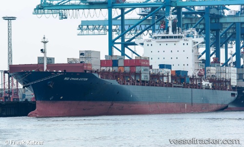
Vessel RIO CHARLESTON IMO: 9362449, MMSI: 255806449 Container Ship
UTC, 1.27650, 104.14608, course: 265, speed: 10.7
UTC, 1.18224, 103.81050, course: 247, speed: 10.3
2026-01-31 01:33:10 UTC, 1.19778, 103.65631, course: 24, speed: 7.2
Live AIS position:
UTC. Near JURONG ISLAND),
updated 2026-01-31 01:33:10 UTC.
Find the position of the vessel RIO CHARLESTON on the map. The latter are known coordinates and path.
marine traffic ship tracker show on live map
The current position of vessel RIO CHARLESTON is 1.19778 lat / 103.65631 lng. Updated: 2026-01-31 01:33:10 UTCCurrently sailing under the flag of Portugal (MAR)
RIO CHARLESTON built in 2008 year
Deadweight:
55301 tDetails:
Last coordinates of the vessel:
UTC, 1.47496, 104.52827, course: 234, speed: 18.5UTC, 1.27650, 104.14608, course: 265, speed: 10.7
UTC, 1.18224, 103.81050, course: 247, speed: 10.3
2026-01-31 01:33:10 UTC, 1.19778, 103.65631, course: 24, speed: 7.2