 vesseltracker.com
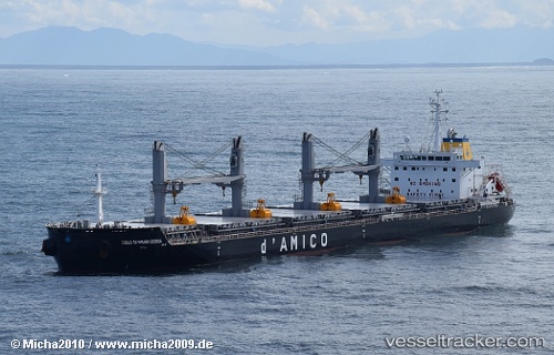
Vessel EMILY OLDENDORFF IMO: 9663740, MMSI: 255806450 Bulk Carrier
UTC, 37.18440, -6.92997, course: 329, speed: 0
UTC, 37.18442, -6.92995, course: 329, speed: 0
2026-03-14 17:22:42 UTC, 37.18439, -6.92994, course: 329, speed: 0
Live Vessel EMILY OLDENDORFF Analytics (details, animations, etc.)
Live AIS position: UTC. Near Punta Umbría), updated 2026-03-14 17:22:42 UTC.Find the position of the vessel EMILY OLDENDORFF on the map. The latter are known coordinates and path.
marine traffic ship tracker show on live map
The current position of vessel EMILY OLDENDORFF is 37.18439 lat / -6.92994 lng. Updated: 2026-03-14 17:22:42 UTCCurrently sailing under the flag of Portugal (MAR)
EMILY OLDENDORFF built in 2015 year
Deadweight:
39202 tDetails:
Last coordinates of the vessel:
UTC, 37.18438, -6.92998, course: 329, speed: 0UTC, 37.18440, -6.92997, course: 329, speed: 0
UTC, 37.18442, -6.92995, course: 329, speed: 0
2026-03-14 17:22:42 UTC, 37.18439, -6.92994, course: 329, speed: 0