 vesseltracker.com
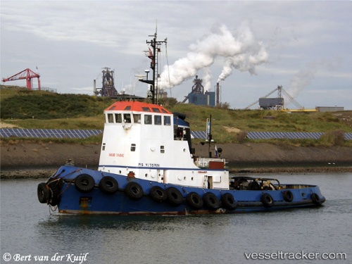
Vessel Mikela 1 IMO: 7111042, MMSI: 256000330 Tug
UTC, 35.83167, 14.54833, course: -1, speed: 0
UTC, 35.83289, 14.54927, course: -1, speed: 0.8
2026-03-02 19:33:09 UTC, 35.83291, 14.54935, course: -1, speed: 0.2
Live AIS position:
UTC. Near Birzebbugia),
updated 2026-03-02 19:33:09 UTC.
Find the position of the vessel Mikela 1 on the map. The latter are known coordinates and path.
marine traffic ship tracker show on live map
The current position of vessel Mikela 1 is 35.83291 lat / 14.54935 lng. Updated: 2026-03-02 19:33:09 UTCCurrently sailing under the flag of Malta
Mikela 1 built in 1972 year
Deadweight:
171 tDetails:
Last coordinates of the vessel:
UTC, 35.83167, 14.54833, course: -1, speed: 0UTC, 35.83167, 14.54833, course: -1, speed: 0
UTC, 35.83289, 14.54927, course: -1, speed: 0.8
2026-03-02 19:33:09 UTC, 35.83291, 14.54935, course: -1, speed: 0.2