 vesseltracker.com
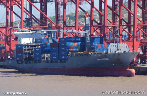
Vessel CMA CGM AQABA IMO: 9334820, MMSI: 256148000 Container Ship
UTC, -33.91298, 18.45166, course: 316, speed: 0
UTC, -33.91299, 18.45161, course: 316, speed: 0
2026-01-14 00:48:08 UTC, -33.91297, 18.45167, course: 316, speed: 0
Live AIS position:
UTC. Near Salt River),
updated 2026-01-14 00:48:08 UTC.
Find the position of the vessel CMA CGM AQABA on the map. The latter are known coordinates and path.
marine traffic ship tracker show on live map
The current position of vessel CMA CGM AQABA is -33.91297 lat / 18.45167 lng. Updated: 2026-01-14 00:48:08 UTCCurrently sailing under the flag of Malta
CMA CGM AQABA built in 2007 year
Deadweight:
23451 tDetails:
Last coordinates of the vessel:
UTC, -33.91295, 18.45161, course: 316, speed: 0UTC, -33.91298, 18.45166, course: 316, speed: 0
UTC, -33.91299, 18.45161, course: 316, speed: 0
2026-01-14 00:48:08 UTC, -33.91297, 18.45167, course: 316, speed: 0