 vesseltracker.com
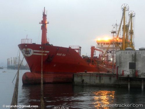
Vessel Santa Lucia IMO: 9260500, MMSI: 256445000 Chemical Oil Products Tanker
UTC, 35.88499, 14.49823, course: 102, speed: 0
UTC, 35.88499, 14.49824, course: 101, speed: 0
2026-03-24 21:54:55 UTC, 35.88499, 14.49823, course: 101, speed: 0
Live Vessel Santa Lucia Analytics (details, animations, etc.)
Live AIS position: UTC. Near Floriana), updated 2026-03-24 21:54:55 UTC.Find the position of the vessel Santa Lucia on the map. The latter are known coordinates and path.
marine traffic ship tracker show on live map
The current position of vessel Santa Lucia is 35.88499 lat / 14.49823 lng. Updated: 2026-03-24 21:54:55 UTCDetails:
Last coordinates of the vessel:
UTC, 35.88499, 14.49823, course: 102, speed: 0UTC, 35.88499, 14.49823, course: 102, speed: 0
UTC, 35.88499, 14.49824, course: 101, speed: 0
2026-03-24 21:54:55 UTC, 35.88499, 14.49823, course: 101, speed: 0