 vesseltracker.com
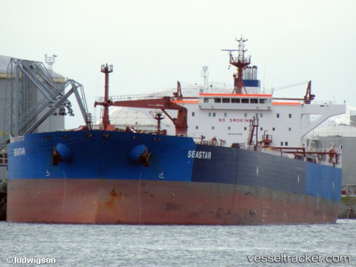
Vessel Seastar IMO: 9373656, MMSI: 256702000 Crude Oil Tanker
UTC, 45.61195, 13.77842, course: 249, speed: 0
UTC, 45.61192, 13.77841, course: 249, speed: 0
2026-01-15 13:59:52 UTC, 45.61195, 13.77844, course: 249, speed: 0
Live AIS position:
UTC. Near MUGGIA),
updated 2026-01-15 13:59:52 UTC.
Find the position of the vessel Seastar on the map. The latter are known coordinates and path.
marine traffic ship tracker show on live map
The current position of vessel Seastar is 45.61195 lat / 13.77844 lng. Updated: 2026-01-15 13:59:52 UTCCurrently sailing under the flag of Malta
Seastar built in 2008 year
Deadweight:
115639 tDetails:
Last coordinates of the vessel:
UTC, 45.61196, 13.77845, course: 249, speed: 0UTC, 45.61195, 13.77842, course: 249, speed: 0
UTC, 45.61192, 13.77841, course: 249, speed: 0
2026-01-15 13:59:52 UTC, 45.61195, 13.77844, course: 249, speed: 0