 vesseltracker.com
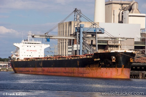
Vessel Sidari IMO: 9363053, MMSI: 256944000 Bulk Carrier
UTC, 47.62415, -122.37137, course: 134, speed: 0
UTC, 47.62411, -122.37150, course: 133, speed: 0
2026-02-14 22:20:28 UTC, 47.62436, -122.37133, course: 133, speed: 0
Live AIS position:
UTC. Near Interbay),
updated 2026-02-14 22:20:28 UTC.
Find the position of the vessel Sidari on the map. The latter are known coordinates and path.
marine traffic ship tracker show on live map
The current position of vessel Sidari is 47.62436 lat / -122.37133 lng. Updated: 2026-02-14 22:20:28 UTCCurrently sailing under the flag of Malta
Sidari built in 2007 year
Deadweight:
75204 tDetails:
Last coordinates of the vessel:
UTC, 47.62419, -122.37134, course: 134, speed: 0UTC, 47.62415, -122.37137, course: 134, speed: 0
UTC, 47.62411, -122.37150, course: 133, speed: 0
2026-02-14 22:20:28 UTC, 47.62436, -122.37133, course: 133, speed: 0