 vesseltracker.com
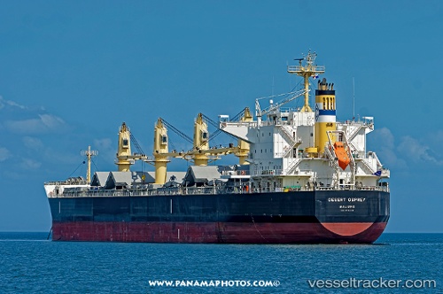
 OCEAN PERA
Current Status
Where is the vessel?
OCEAN PERA is currently in Near Cabo de Palos, based on AIS data received about 2h ago.
Latest AIS update:
Current position: 37.62496° N, 0.51332° W (Near Cabo de Palos)
Average speed (last 7 days): Loading…
Average speed (last 30 days): Loading…
Vessel profile: OCEAN PERA is a Cargo with dimensions m x m.
This page combines live AIS, route history, probable destination signals, nearby traffic, and port activity for practical vessel monitoring.
The current position of vessel OCEAN PERA is 37.62496 lat / -0.51332 lng. Updated: 2026-03-25 08:06:26 UTCNearest reference points:
- Near Torre Horadada
- Near Playa San Agustin
- Near TORREVIEJA
Currently sailing under the flag of Malta ![]()
Details:
Live Vessel OCEAN PERA Analytics (details, animations, etc.)
Recent AIS points (UTC):
2026-03-25 01:31:35 UTC · 38.91888, 0.32657 · SOG 13.4 kn · COG 152°2026-03-25 03:32:55 UTC · 38.51374, 0.23690 · SOG 13.7 kn · COG 218°
2026-03-25 05:22:45 UTC · 38.15629, -0.05877 · SOG 14.3 kn · COG 216°
2026-03-25 08:06:26 UTC · 37.62496, -0.51332 · SOG 14.1 kn · COG 215°