 vesseltracker.com
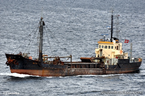
Vessel Sandtroll IMO: 7014347, MMSI: 257007520 Dredger
UTC, 60.47800, 5.25030, course: 161, speed: 5.9
UTC, 60.39251, 5.29042, course: 289, speed: 0
2026-03-02 23:25:44 UTC, 60.39255, 5.29040, course: 290, speed: 0
Live AIS position:
UTC. Near Damsgård),
updated 2026-03-02 23:25:44 UTC.
Find the position of the vessel Sandtroll on the map. The latter are known coordinates and path.
marine traffic ship tracker show on live map
The current position of vessel Sandtroll is 60.39255 lat / 5.29040 lng. Updated: 2026-03-02 23:25:44 UTCCurrently sailing under the flag of Norway
Sandtroll built in 1970 year
Deadweight:
869 tDetails:
Last coordinates of the vessel:
UTC, 60.59654, 5.43739, course: 75, speed: 0UTC, 60.47800, 5.25030, course: 161, speed: 5.9
UTC, 60.39251, 5.29042, course: 289, speed: 0
2026-03-02 23:25:44 UTC, 60.39255, 5.29040, course: 290, speed: 0