 vesseltracker.com
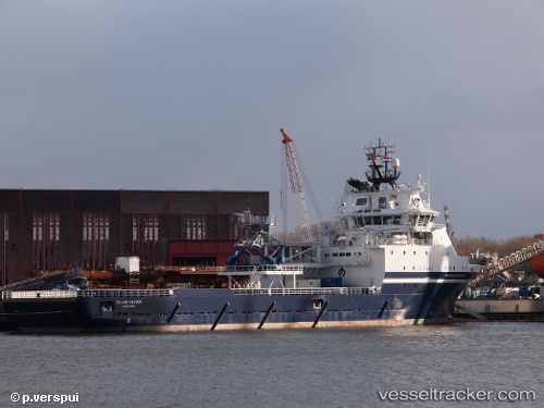
Vessel Island Condor IMO: 9695042, MMSI: 257026000 Offshore Tug Supply Ship
UTC, 28.08833, -15.40167, course: -1, speed: 0
UTC, 28.09070, -15.40281, course: 3, speed: 0.5
2026-03-10 07:40:45 UTC, 28.09057, -15.40293, course: 2, speed: 0.3
Live Vessel Island Condor Analytics (details, animations, etc.)
Live AIS position: UTC. Near Las Palmas de Gran Canaria), updated 2026-03-10 07:40:45 UTC.Find the position of the vessel Island Condor on the map. The latter are known coordinates and path.
marine traffic ship tracker show on live map
The current position of vessel Island Condor is 28.09057 lat / -15.40293 lng. Updated: 2026-03-10 07:40:45 UTCCurrently sailing under the flag of Norway
Details:
Last coordinates of the vessel:
UTC, 28.08992, -15.40167, course: 47, speed: 0.5UTC, 28.08833, -15.40167, course: -1, speed: 0
UTC, 28.09070, -15.40281, course: 3, speed: 0.5
2026-03-10 07:40:45 UTC, 28.09057, -15.40293, course: 2, speed: 0.3