 vesseltracker.com
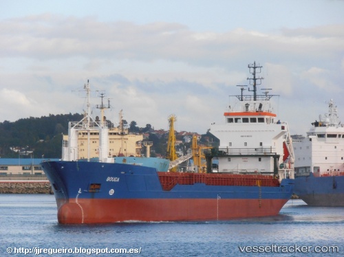
Vessel Tifjord IMO: 9190353, MMSI: 257114000 Multi Purpose Carrier
UTC, 58.27488, 6.88665, course: 57, speed: 0
UTC, 58.27487, 6.88661, course: -1, speed: 0
2026-03-04 13:35:43 UTC, 58.27489, 6.88662, course: 57, speed: 0
Live Vessel Tifjord Analytics (details, animations, etc.)
Live AIS position: UTC. Near Flekkefjorden), updated 2026-03-04 13:35:43 UTC.Find the position of the vessel Tifjord on the map. The latter are known coordinates and path.
marine traffic ship tracker show on live map
The current position of vessel Tifjord is 58.27489 lat / 6.88662 lng. Updated: 2026-03-04 13:35:43 UTCCurrently sailing under the flag of Norway
Tifjord built in 1999 year
Deadweight:
5065 tDetails:
Last coordinates of the vessel:
UTC, 58.16333, 6.57833, course: -1, speed: 10UTC, 58.27488, 6.88665, course: 57, speed: 0
UTC, 58.27487, 6.88661, course: -1, speed: 0
2026-03-04 13:35:43 UTC, 58.27489, 6.88662, course: 57, speed: 0