 vesseltracker.com
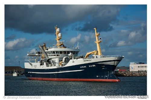
Vessel Havglans IMO: 9383833, MMSI: 257120500 Fish Carrier
UTC, 60.59378, 4.84891, course: 47, speed: 0
UTC, 60.59378, 4.84893, course: 47, speed: 0
2026-03-08 07:33:59 UTC, 60.59381, 4.84894, course: 47, speed: 0
Live Vessel Havglans Analytics (details, animations, etc.)
Live AIS position: UTC. Near Stura), updated 2026-03-08 07:33:59 UTC.Find the position of the vessel Havglans on the map. The latter are known coordinates and path.
marine traffic ship tracker show on live map
The current position of vessel Havglans is 60.59381 lat / 4.84894 lng. Updated: 2026-03-08 07:33:59 UTCCurrently sailing under the flag of Norway
Havglans built in 2007 year
Deadweight:
1500 tDetails:
Last coordinates of the vessel:
UTC, 60.59380, 4.84892, course: 47, speed: 0UTC, 60.59378, 4.84891, course: 47, speed: 0
UTC, 60.59378, 4.84893, course: 47, speed: 0
2026-03-08 07:33:59 UTC, 60.59381, 4.84894, course: 47, speed: 0