 vesseltracker.com
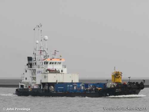
Vessel Seisund IMO: 8918564, MMSI: 257191000 Salvage Ship
UTC, 60.52333, 5.31850, course: 120, speed: 0
UTC, 60.52333, 5.31850, course: 120, speed: 0
2026-02-04 05:36:54 UTC, 60.52333, 5.31850, course: 120, speed: 0
Live AIS position:
UTC. Near Hordvik),
updated 2026-02-04 05:36:54 UTC.
Find the position of the vessel Seisund on the map. The latter are known coordinates and path.
marine traffic ship tracker show on live map
The current position of vessel Seisund is 60.52333 lat / 5.31850 lng. Updated: 2026-02-04 05:36:54 UTCCurrently sailing under the flag of Norway
Seisund built in 1991 year
Deadweight:
615 tDetails:
Last coordinates of the vessel:
UTC, 60.52333, 5.31850, course: 120, speed: 0UTC, 60.52333, 5.31850, course: 120, speed: 0
UTC, 60.52333, 5.31850, course: 120, speed: 0
2026-02-04 05:36:54 UTC, 60.52333, 5.31850, course: 120, speed: 0