 vesseltracker.com
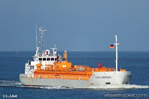
Vessel Gerda IMO: 9279410, MMSI: 257206000 Co2 Tanker
UTC, 55.47807, 10.54322, course: 51, speed: 0
UTC, 55.47807, 10.54322, course: 50, speed: 0
2026-03-25 03:31:34 UTC, 55.47807, 10.54321, course: 50, speed: 0
Live Vessel Gerda Analytics (details, animations, etc.)
Live AIS position: UTC. Near LINDOE), updated 2026-03-25 03:31:34 UTC.Find the position of the vessel Gerda on the map. The latter are known coordinates and path.
marine traffic ship tracker show on live map
The current position of vessel Gerda is 55.47807 lat / 10.54321 lng. Updated: 2026-03-25 03:31:34 UTCNearest reference points:
- Near Lindholm Havn
- Near Lundeborg
- Near Svendborg
Currently sailing under the flag of Norway
Gerda built in 2004 year
Deadweight:
3480 tDetails:
Last coordinates of the vessel:
UTC, 55.47807, 10.54322, course: 50, speed: 0UTC, 55.47807, 10.54322, course: 51, speed: 0
UTC, 55.47807, 10.54322, course: 50, speed: 0
2026-03-25 03:31:34 UTC, 55.47807, 10.54321, course: 50, speed: 0