 vesseltracker.com
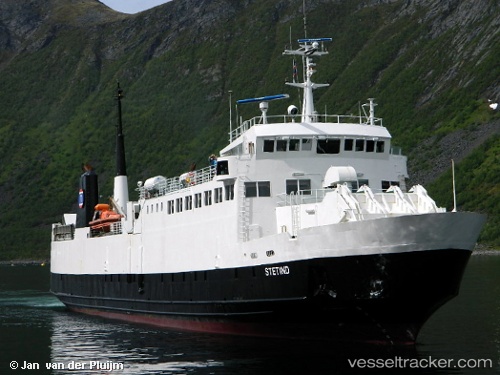
Vessel Stetind IMO: 7633662, MMSI: 257215500 Passenger Ro Ro Cargo Ship
UTC, 62.60792, 6.44890, course: 228, speed: 0
UTC, 62.63958, 6.52477, course: 280, speed: 2
2026-03-04 22:20:10 UTC, 62.63973, 6.52367, course: 270, speed: 0
Live Vessel Stetind Analytics (details, animations, etc.)
Live AIS position: UTC. Near Brattvåg), updated 2026-03-04 22:20:10 UTC.Find the position of the vessel Stetind on the map. The latter are known coordinates and path.
marine traffic ship tracker show on live map
The current position of vessel Stetind is 62.63973 lat / 6.52367 lng. Updated: 2026-03-04 22:20:10 UTCCurrently sailing under the flag of Norway
Stetind built in 1977 year
Deadweight:
840 tDetails:
Last coordinates of the vessel:
UTC, 62.60820, 6.44940, course: 51, speed: 0UTC, 62.60792, 6.44890, course: 228, speed: 0
UTC, 62.63958, 6.52477, course: 280, speed: 2
2026-03-04 22:20:10 UTC, 62.63973, 6.52367, course: 270, speed: 0