 vesseltracker.com
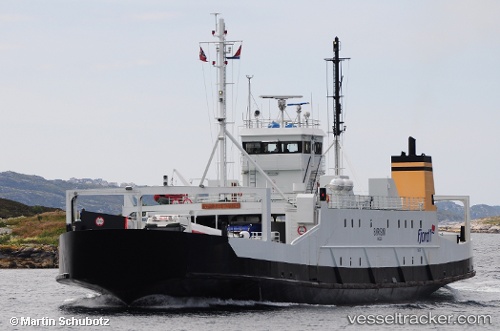
Vessel Bjornsund IMO: 7805215, MMSI: 257219400 Passenger Ro Ro Cargo Ship
UTC, 62.35437, 6.08479, course: 241, speed: 0
UTC, 62.35434, 6.08468, course: 241, speed: 0
2026-03-03 05:44:42 UTC, 62.35434, 6.08469, course: 242, speed: 0
Live AIS position:
UTC. Near HJORUNGAVAG),
updated 2026-03-03 05:44:42 UTC.
Find the position of the vessel Bjornsund on the map. The latter are known coordinates and path.
marine traffic ship tracker show on live map
The current position of vessel Bjornsund is 62.35434 lat / 6.08469 lng. Updated: 2026-03-03 05:44:42 UTCCurrently sailing under the flag of Norway
Bjornsund built in 1979 year
Deadweight:
512 tDetails:
Last coordinates of the vessel:
UTC, 62.35434, 6.08467, course: 241, speed: 0UTC, 62.35437, 6.08479, course: 241, speed: 0
UTC, 62.35434, 6.08468, course: 241, speed: 0
2026-03-03 05:44:42 UTC, 62.35434, 6.08469, course: 242, speed: 0