 vesseltracker.com
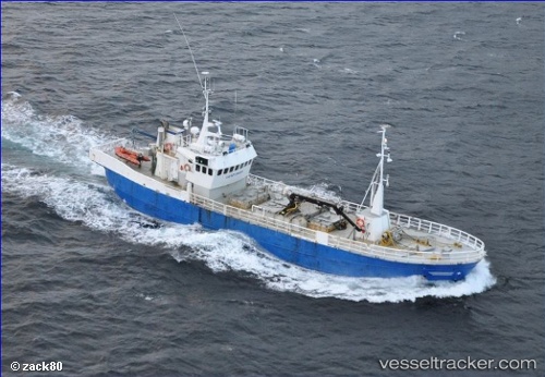
Vessel Veroytrans IMO: 6804317, MMSI: 257261000 General Cargo Ship
UTC, 63.63922, 8.79802, course: -1, speed: 0
UTC, 63.63922, 8.79809, course: -1, speed: 0
2026-03-01 09:53:34 UTC, 63.63922, 8.79808, course: -1, speed: 0
Live AIS position:
UTC. Near Dolmøy),
updated 2026-03-01 09:53:34 UTC.
Find the position of the vessel Veroytrans on the map. The latter are known coordinates and path.
marine traffic ship tracker show on live map
The current position of vessel Veroytrans is 63.63922 lat / 8.79808 lng. Updated: 2026-03-01 09:53:34 UTCCurrently sailing under the flag of Norway
Veroytrans built in 1967 year
Details:
Last coordinates of the vessel:
UTC, 63.63921, 8.79806, course: -1, speed: 0UTC, 63.63922, 8.79802, course: -1, speed: 0
UTC, 63.63922, 8.79809, course: -1, speed: 0
2026-03-01 09:53:34 UTC, 63.63922, 8.79808, course: -1, speed: 0