 vesseltracker.com
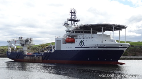
Vessel Island Pride IMO: 9630547, MMSI: 257406000 Offshore Support Vessel
UTC, 29.85502, -93.94458, course: 220, speed: 0
UTC, 29.85333, -93.94333, course: -1, speed: 0
2026-01-14 07:29:02 UTC, 29.85499, -93.94460, course: 220, speed: 0
Live AIS position:
UTC. Near Port Arthur),
updated 2026-01-14 07:29:02 UTC.
Find the position of the vessel Island Pride on the map. The latter are known coordinates and path.
marine traffic ship tracker show on live map
The current position of vessel Island Pride is 29.85499 lat / -93.94460 lng. Updated: 2026-01-14 07:29:02 UTCDetails:
Last coordinates of the vessel:
UTC, 29.85500, -93.94461, course: 220, speed: 0UTC, 29.85502, -93.94458, course: 220, speed: 0
UTC, 29.85333, -93.94333, course: -1, speed: 0
2026-01-14 07:29:02 UTC, 29.85499, -93.94460, course: 220, speed: 0