 vesseltracker.com
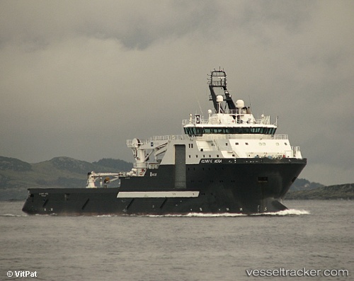
Vessel Skandi Hera IMO: 9424730, MMSI: 257411000 Offshore Tug Supply Ship
UTC, -6.37667, 12.15667, course: -1, speed: 0
UTC, -6.37500, 12.15833, course: -1, speed: 0
2026-03-08 02:48:15 UTC, -6.38066, 12.15292, course: 240, speed: 0.4
Live Vessel Skandi Hera Analytics (details, animations, etc.)
Live AIS position: UTC. Near Essungo Terminal), updated 2026-03-08 02:48:15 UTC.Find the position of the vessel Skandi Hera on the map. The latter are known coordinates and path.
marine traffic ship tracker show on live map
The current position of vessel Skandi Hera is -6.38066 lat / 12.15292 lng. Updated: 2026-03-08 02:48:15 UTCCurrently sailing under the flag of Norway
Skandi Hera built in 2009 year
Deadweight:
4925 tDetails:
Last coordinates of the vessel:
UTC, -6.38171, 12.15041, course: 240, speed: 0.1UTC, -6.37667, 12.15667, course: -1, speed: 0
UTC, -6.37500, 12.15833, course: -1, speed: 0
2026-03-08 02:48:15 UTC, -6.38066, 12.15292, course: 240, speed: 0.4