 vesseltracker.com
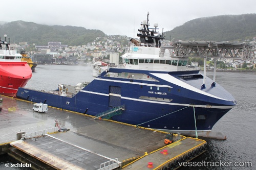
Vessel Normand Drott IMO: 9447964, MMSI: 257468000 Offshore Tug Supply Ship
UTC, 60.39339, 5.25445, course: -1, speed: 0
UTC, 60.39343, 5.25448, course: 89, speed: 0
2026-03-03 13:43:26 UTC, 60.39338, 5.25445, course: 89, speed: 0
Live AIS position:
UTC. Near Skålevik),
updated 2026-03-03 13:43:26 UTC.
Find the position of the vessel Normand Drott on the map. The latter are known coordinates and path.
marine traffic ship tracker show on live map
The current position of vessel Normand Drott is 60.39338 lat / 5.25445 lng. Updated: 2026-03-03 13:43:26 UTCCurrently sailing under the flag of Norway
Normand Drott built in 2010 year
Deadweight:
4611 tDetails:
Last coordinates of the vessel:
UTC, 60.39339, 5.25442, course: 89, speed: 0UTC, 60.39339, 5.25445, course: -1, speed: 0
UTC, 60.39343, 5.25448, course: 89, speed: 0
2026-03-03 13:43:26 UTC, 60.39338, 5.25445, course: 89, speed: 0