 vesseltracker.com
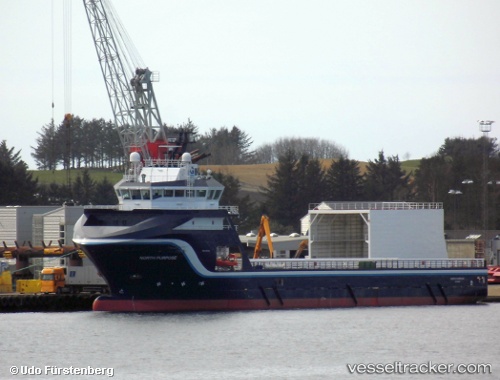
Vessel North Purpose IMO: 9439462, MMSI: 257491000 Offshore Tug Supply Ship
UTC, 58.92412, 5.59412, course: 23, speed: 0
UTC, 58.92413, 5.59415, course: 23, speed: 0
2026-01-20 03:32:51 UTC, 58.92412, 5.59414, course: 23, speed: 0
Live AIS position:
UTC. Near TANANGER),
updated 2026-01-20 03:32:51 UTC.
Find the position of the vessel North Purpose on the map. The latter are known coordinates and path.
marine traffic ship tracker show on live map
The current position of vessel North Purpose is 58.92412 lat / 5.59414 lng. Updated: 2026-01-20 03:32:51 UTCDetails:
Last coordinates of the vessel:
UTC, 58.92412, 5.59415, course: 23, speed: 0UTC, 58.92412, 5.59412, course: 23, speed: 0
UTC, 58.92413, 5.59415, course: 23, speed: 0
2026-01-20 03:32:51 UTC, 58.92412, 5.59414, course: 23, speed: 0