 vesseltracker.com
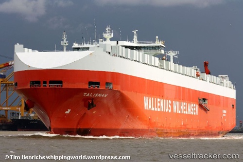
Vessel Talisman IMO: 9191319, MMSI: 257613000 Vehicles Carrier
UTC, 37.80833, -76.18500, course: -1, speed: 18
UTC, 37.11199, -76.12523, course: 155, speed: 16.4
2026-03-17 03:22:22 UTC, 36.92217, -75.97042, course: 115, speed: 11.4
Live Vessel Talisman Analytics (details, animations, etc.)
Live AIS position: UTC. Near Cape Henry), updated 2026-03-17 03:22:22 UTC.Find the position of the vessel Talisman on the map. The latter are known coordinates and path.
marine traffic ship tracker show on live map
The current position of vessel Talisman is 36.92217 lat / -75.97042 lng. Updated: 2026-03-17 03:22:22 UTCDetails:
Last coordinates of the vessel:
UTC, 38.23199, -76.26069, course: 157, speed: 19.1UTC, 37.80833, -76.18500, course: -1, speed: 18
UTC, 37.11199, -76.12523, course: 155, speed: 16.4
2026-03-17 03:22:22 UTC, 36.92217, -75.97042, course: 115, speed: 11.4