 vesseltracker.com
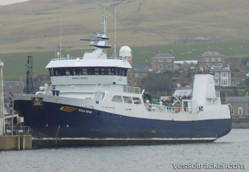
Ronja Viking
Current StatusLive Vessel Ronja Viking Analytics (details, animations, etc.)
Where is the vessel?
Ronja Viking is currently in Near MALLAIG, based on AIS data received about 2h ago.
Latest AIS update:
Current position: 57.00824° N, 5.82803° W (Near MALLAIG)
Vessel profile: Ronja Viking is a Fish Carrier with dimensions 57m x 12m.
This page combines live AIS, route history, probable destination signals, nearby traffic, and port activity for practical vessel monitoring.
The current position of vessel Ronja Viking is 57.00824 lat / -5.82803 lng. Updated: 2026-03-25 05:21:33 UTCNearest reference points:
- Near KYLE OF LOCHALSH
- Near Fishnish, Isle of Mull
- Near CRAIGNURE PIER
Currently sailing under the flag of Norway
Ronja Viking built in 2006 year
Deadweight:
1250 tDetails:
Last coordinates of the vessel:
2026-03-24 23:55:47 UTC, 57.06464, -5.85935, course: 37, speed: 2.82026-03-25 02:27:47 UTC, 57.11001, -5.79413, course: 223, speed: 3.4
2026-03-25 03:52:26 UTC, 57.04680, -5.85403, course: 228, speed: 3.3
2026-03-25 05:21:33 UTC, 57.00824, -5.82803, course: 251, speed: 0