 vesseltracker.com
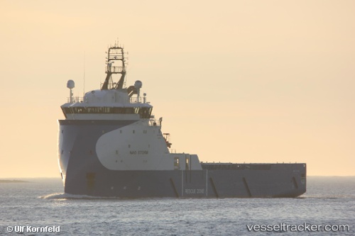
Vessel Nao Storm IMO: 9722510, MMSI: 257734000 Offshore Tug Supply Ship
UTC, 57.14045, -2.08206, course: 91, speed: 0
UTC, 57.14045, -2.08208, course: 89, speed: 0
2026-02-04 15:27:18 UTC, 57.14046, -2.08204, course: 90, speed: 0
Live AIS position:
UTC. Near Aberdeen),
updated 2026-02-04 15:27:18 UTC.
Find the position of the vessel Nao Storm on the map. The latter are known coordinates and path.
marine traffic ship tracker show on live map
The current position of vessel Nao Storm is 57.14046 lat / -2.08204 lng. Updated: 2026-02-04 15:27:18 UTCCurrently sailing under the flag of Norway
Details:
Last coordinates of the vessel:
UTC, 57.14319, -2.08716, course: 282, speed: 0UTC, 57.14045, -2.08206, course: 91, speed: 0
UTC, 57.14045, -2.08208, course: 89, speed: 0
2026-02-04 15:27:18 UTC, 57.14046, -2.08204, course: 90, speed: 0