 vesseltracker.com
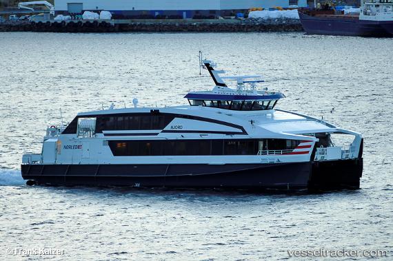
Vessel Njord IMO: 9631539, MMSI: 257781000 Passenger Ro Ro Cargo Ship
UTC, 61.16642, 5.01745, course: 171, speed: 27.8
UTC, 60.69630, 5.08560, course: 130, speed: 28.2
2026-03-01 20:12:01 UTC, 60.39528, 5.32237, course: 122, speed: 0
Live AIS position:
UTC. Near Bergen),
updated 2026-03-01 20:12:01 UTC.
Find the position of the vessel Njord on the map. The latter are known coordinates and path.
marine traffic ship tracker show on live map
The current position of vessel Njord is 60.39528 lat / 5.32237 lng. Updated: 2026-03-01 20:12:01 UTCCurrently sailing under the flag of Norway
Njord built in 2012 year
Deadweight:
40 tDetails:
Last coordinates of the vessel:
UTC, 61.83067, 5.24259, course: 246, speed: 29.6UTC, 61.16642, 5.01745, course: 171, speed: 27.8
UTC, 60.69630, 5.08560, course: 130, speed: 28.2
2026-03-01 20:12:01 UTC, 60.39528, 5.32237, course: 122, speed: 0