 vesseltracker.com
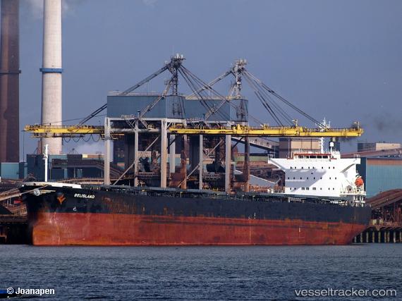
Vessel BELISLAND IMO: 9698197, MMSI: 257818000 Bulk Carrier
UTC, 30.25836, 122.25158, course: 12, speed: 0
UTC, 30.25836, 122.25154, course: 11, speed: 0
2026-03-02 11:25:47 UTC, 30.25829, 122.25152, course: 11, speed: 0
Live AIS position:
UTC. Near JINHAI HEAVY INDUSTR),
updated 2026-03-02 11:25:47 UTC.
Find the position of the vessel BELISLAND on the map. The latter are known coordinates and path.
marine traffic ship tracker show on live map
The current position of vessel BELISLAND is 30.25829 lat / 122.25152 lng. Updated: 2026-03-02 11:25:47 UTCCurrently sailing under the flag of Norway (NIS)
BELISLAND built in 2016 year
Deadweight:
61252 tDetails:
Last coordinates of the vessel:
UTC, 30.25832, 122.25158, course: 11, speed: 0UTC, 30.25836, 122.25158, course: 12, speed: 0
UTC, 30.25836, 122.25154, course: 11, speed: 0
2026-03-02 11:25:47 UTC, 30.25829, 122.25152, course: 11, speed: 0