 vesseltracker.com
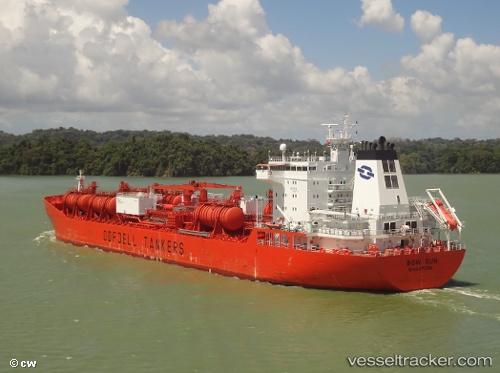
Vessel BOW SUN IMO: 9197284, MMSI: 257892000 Chemical/Oil Products Tanker
UTC, 3.04672, 101.35623, course: 177, speed: 0
UTC, 3.04671, 101.35621, course: 177, speed: 0
2026-03-20 15:50:54 UTC, 3.04672, 101.35621, course: 177, speed: 0
Live Vessel BOW SUN Analytics (details, animations, etc.)
Live AIS position: UTC. Near Port Klang (Ferry Port)), updated 2026-03-20 15:50:54 UTC.Find the position of the vessel BOW SUN on the map. The latter are known coordinates and path.
marine traffic ship tracker show on live map
The current position of vessel BOW SUN is 3.04672 lat / 101.35621 lng. Updated: 2026-03-20 15:50:54 UTCCurrently sailing under the flag of Norway (NIS)
BOW SUN built in 2003 year
Deadweight:
49466 tDetails:
Last coordinates of the vessel:
UTC, 3.04670, 101.35620, course: 177, speed: 0UTC, 3.04672, 101.35623, course: 177, speed: 0
UTC, 3.04671, 101.35621, course: 177, speed: 0
2026-03-20 15:50:54 UTC, 3.04672, 101.35621, course: 177, speed: 0