 vesseltracker.com
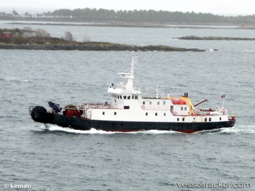
Vessel Nordkabel IMO: 6930544, MMSI: 258104000 Cable Layer
UTC, 56.66046, 16.36849, course: -1, speed: 0.1
UTC, 56.66046, 16.36849, course: -1, speed: 0.1
2026-02-27 02:10:17 UTC, 56.66046, 16.36849, course: -1, speed: 0.1
Live AIS position:
UTC. Near Kalmar),
updated 2026-02-27 02:10:17 UTC.
Find the position of the vessel Nordkabel on the map. The latter are known coordinates and path.
marine traffic ship tracker show on live map
The current position of vessel Nordkabel is 56.66046 lat / 16.36849 lng. Updated: 2026-02-27 02:10:17 UTCCurrently sailing under the flag of Norway
Nordkabel built in 1969 year
Details:
Last coordinates of the vessel:
UTC, 56.66046, 16.36849, course: -1, speed: 0.1UTC, 56.66046, 16.36849, course: -1, speed: 0.1
UTC, 56.66046, 16.36849, course: -1, speed: 0.1
2026-02-27 02:10:17 UTC, 56.66046, 16.36849, course: -1, speed: 0.1