 vesseltracker.com
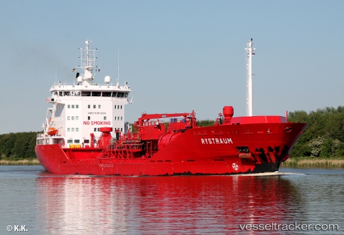
Vessel Rystraum IMO: 9391000, MMSI: 258858000 Chemical Oil Products Tanker
UTC, 59.08745, 4.73299, course: 141, speed: 9.1
UTC, 58.74831, 5.17052, course: 146, speed: 9
2026-01-19 05:33:41 UTC, 58.60754, 5.34708, course: 149, speed: 8.8
Live AIS position:
UTC. Near Varhaug),
updated 2026-01-19 05:33:41 UTC.
Find the position of the vessel Rystraum on the map. The latter are known coordinates and path.
marine traffic ship tracker show on live map
The current position of vessel Rystraum is 58.60754 lat / 5.34708 lng. Updated: 2026-01-19 05:33:41 UTCCurrently sailing under the flag of Norway
Rystraum built in 2009 year
Deadweight:
9597 tDetails:
Last coordinates of the vessel:
UTC, 59.09854, 4.71254, course: 141, speed: 9UTC, 59.08745, 4.73299, course: 141, speed: 9.1
UTC, 58.74831, 5.17052, course: 146, speed: 9
2026-01-19 05:33:41 UTC, 58.60754, 5.34708, course: 149, speed: 8.8