 vesseltracker.com
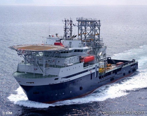
Vessel Island Frontier IMO: 9249520, MMSI: 258866000 Well Stimulation Vessel
UTC, 62.32347, 5.84445, course: 124, speed: 0
UTC, 62.45726, 6.17230, course: 46, speed: 10.3
2026-01-15 10:44:52 UTC, 62.46230, 6.13159, course: 92, speed: 0
Live AIS position:
UTC. Near Alesund),
updated 2026-01-15 10:44:52 UTC.
Find the position of the vessel Island Frontier on the map. The latter are known coordinates and path.
marine traffic ship tracker show on live map
The current position of vessel Island Frontier is 62.46230 lat / 6.13159 lng. Updated: 2026-01-15 10:44:52 UTCDetails:
Last coordinates of the vessel:
UTC, 62.32348, 5.84445, course: 124, speed: 0.1UTC, 62.32347, 5.84445, course: 124, speed: 0
UTC, 62.45726, 6.17230, course: 46, speed: 10.3
2026-01-15 10:44:52 UTC, 62.46230, 6.13159, course: 92, speed: 0