 vesseltracker.com
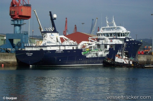
Vessel Ronja Huon IMO: 9682540, MMSI: 258871000 Fish Carrier
UTC, -43.11539, 147.42805, course: 12, speed: 0.3
UTC, -43.11540, 147.42802, course: 12, speed: 0.1
2026-01-15 14:23:14 UTC, -43.11541, 147.42807, course: 13, speed: 0.1
Live AIS position:
UTC. Near BLUNY ISLAND),
updated 2026-01-15 14:23:14 UTC.
Find the position of the vessel Ronja Huon on the map. The latter are known coordinates and path.
marine traffic ship tracker show on live map
The current position of vessel Ronja Huon is -43.11541 lat / 147.42807 lng. Updated: 2026-01-15 14:23:14 UTCCurrently sailing under the flag of Norway
Ronja Huon built in 2014 year
Deadweight:
3800 tDetails:
Last coordinates of the vessel:
UTC, -43.11538, 147.42802, course: 15, speed: 0.1UTC, -43.11539, 147.42805, course: 12, speed: 0.3
UTC, -43.11540, 147.42802, course: 12, speed: 0.1
2026-01-15 14:23:14 UTC, -43.11541, 147.42807, course: 13, speed: 0.1