 vesseltracker.com
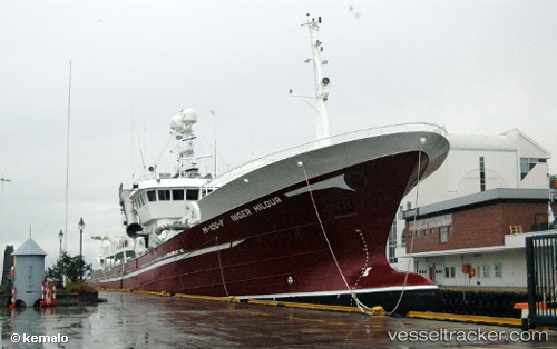
Vessel Vestfart IMO: 9261839, MMSI: 259209000 Fishing Vessel
UTC, 61.97297, 5.14177, course: 85, speed: 0
UTC, 61.97295, 5.14180, course: 85, speed: 0
2026-03-04 17:30:37 UTC, 61.97295, 5.14176, course: 85, speed: 0.1
Live Vessel Vestfart Analytics (details, animations, etc.)
Live AIS position: UTC. Near RAUDEBERG), updated 2026-03-04 17:30:37 UTC.Find the position of the vessel Vestfart on the map. The latter are known coordinates and path.
marine traffic ship tracker show on live map
The current position of vessel Vestfart is 61.97295 lat / 5.14176 lng. Updated: 2026-03-04 17:30:37 UTCCurrently sailing under the flag of Norway
Vestfart built in 2001 year
Deadweight:
1250 tDetails:
Last coordinates of the vessel:
UTC, 61.97295, 5.14182, course: 86, speed: 0.1UTC, 61.97297, 5.14177, course: 85, speed: 0
UTC, 61.97295, 5.14180, course: 85, speed: 0
2026-03-04 17:30:37 UTC, 61.97295, 5.14176, course: 85, speed: 0.1