 vesseltracker.com
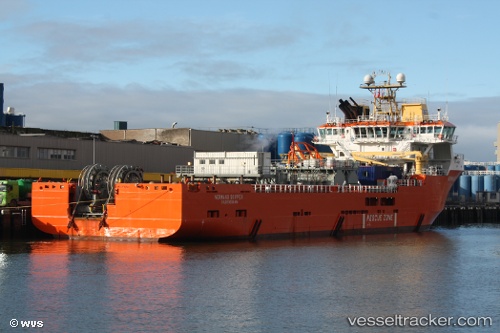
Vessel Normand Skipper IMO: 9331268, MMSI: 259231000 Offshore Tug Supply Ship
UTC, 57.19500, -2.03096, course: 246, speed: 0.1
UTC, 57.14333, -2.08666, course: -1, speed: 0
2026-01-14 09:37:42 UTC, 57.14489, -2.08716, course: 109, speed: 0
Live AIS position:
UTC. Near Aberdeen),
updated 2026-01-14 09:37:42 UTC.
Find the position of the vessel Normand Skipper on the map. The latter are known coordinates and path.
marine traffic ship tracker show on live map
The current position of vessel Normand Skipper is 57.14489 lat / -2.08716 lng. Updated: 2026-01-14 09:37:42 UTCCurrently sailing under the flag of Norway
Normand Skipper built in 2005 year
Deadweight:
6400 tDetails:
Last coordinates of the vessel:
UTC, 57.19491, -2.03052, course: 243, speed: 0.4UTC, 57.19500, -2.03096, course: 246, speed: 0.1
UTC, 57.14333, -2.08666, course: -1, speed: 0
2026-01-14 09:37:42 UTC, 57.14489, -2.08716, course: 109, speed: 0