 vesseltracker.com
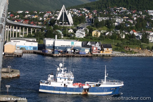
Vessel Stattegg IMO: 8422137, MMSI: 259247000 Fishing Vessel
UTC, 61.98472, 5.13975, course: -1, speed: 0
UTC, 61.98471, 5.13976, course: -1, speed: 0
2026-03-17 03:50:48 UTC, 61.98479, 5.13972, course: -1, speed: 0
Live Vessel Stattegg Analytics (details, animations, etc.)
Live AIS position: UTC. Near RAUDEBERG), updated 2026-03-17 03:50:48 UTC.Find the position of the vessel Stattegg on the map. The latter are known coordinates and path.
marine traffic ship tracker show on live map
The current position of vessel Stattegg is 61.98479 lat / 5.13972 lng. Updated: 2026-03-17 03:50:48 UTCCurrently sailing under the flag of Norway
Details:
Last coordinates of the vessel:
UTC, 61.98465, 5.13984, course: -1, speed: 0UTC, 61.98472, 5.13975, course: -1, speed: 0
UTC, 61.98471, 5.13976, course: -1, speed: 0
2026-03-17 03:50:48 UTC, 61.98479, 5.13972, course: -1, speed: 0