 vesseltracker.com
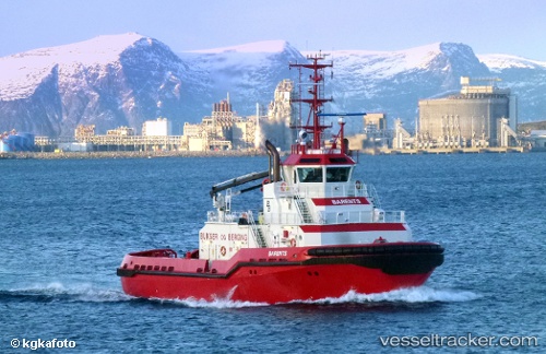
Vessel Barents IMO: 9334765, MMSI: 259250000 Offshore Tug Supply Ship
UTC, 68.23328, 14.53884, course: 343, speed: 0
UTC, 68.23311, 14.53899, course: 342, speed: 0
2026-01-18 19:47:08 UTC, 68.23312, 14.53894, course: 342, speed: 0
Live AIS position:
UTC. Near Svolvær Osan),
updated 2026-01-18 19:47:08 UTC.
Find the position of the vessel Barents on the map. The latter are known coordinates and path.
marine traffic ship tracker show on live map
The current position of vessel Barents is 68.23312 lat / 14.53894 lng. Updated: 2026-01-18 19:47:08 UTCCurrently sailing under the flag of Norway
Barents built in 2006 year
Deadweight:
690 tDetails:
Last coordinates of the vessel:
UTC, 68.23312, 14.53894, course: 343, speed: 0UTC, 68.23328, 14.53884, course: 343, speed: 0
UTC, 68.23311, 14.53899, course: 342, speed: 0
2026-01-18 19:47:08 UTC, 68.23312, 14.53894, course: 342, speed: 0